Assisted gps and glonass. GPS satellite navigation system - principle, diagram, application
2 years ago


It would be more correct to answer this question in the simplest way: it is in the letter “A” in the second abbreviation that all the difference lies. After all, A-GPS is Assisted GPS. At the same time, GPS, that is, Global Positioning System, is a global positioning system.
In other words, this satellite system navigation. The one that provides distance, time and location measurements. Allows you to determine the location and speed of objects anywhere.
However, if we answer the question in essence, then we must first say that A-GPS differs from GPS in its parameters. As a rule, cellular devices are not equipped with a high-quality GPS receiver that could provide confident reception in a city where high-rise buildings are located everywhere. But GPS can provide this most reliable reception.
A-GPS is a technology using which the receiver can receive part of the navigation data from external sources. To obtain such information, they resort to the help of operator base stations cellular communications. More precisely, A-GPS is a technology that speeds up the “cold start” of a GPS receiver.

Acceleration occurs due to the fact that the necessary information is provided through various alternative communication channels. And therefore it is often used in cell phones, which contain a GPS receiver. A-GPS algorithms require a communication channel with remote server. It provides information to the receiver.
For mobile devices, this channel is usually cellular. And in order to transmit information, the device must be within the coverage area of the cellular operator's base station and have access to global network.
A-GPS can be used in different ways. Often mobile device Does not receive satellite signals at all. It determines coordinates based on signals GSM networks, if the area is very densely covered with stations. In other cases, the receiver receives satellite signals, and the channel GPRS operator provides an almanac, ephemeris and satellite list.
It is also possible that the provider providing the A-GPS service receives the data that the user received from satellites and returns ready-made coordinate values. It is important to note that the use of GPS signals is a free service. The A-GPS service is paid according to the tariffs set by the cellular provider.
One of the two largest global satellite positioning systems - GPS - can be used in a standard format or as an A-GPS service. What are the main features of these technologies?
Facts about GPS
GPS system is intended to determine geographical coordinates object on which a receiver, navigator or other device capable of receiving GPS signals from satellite. This system involves the use of the WGS 84 standard, which allows the coordinates of an object on the Earth’s surface to be determined in three dimensions with an accuracy of 2 cm. In addition, navigation by GPS technology It also allows you to measure the speed of movement of a receiver or similar device on the surface of the Earth.
Facts about A-GPS
A-GPS technology complements the GPS standard in several aspects. First of all, in terms of accelerating the operation of receivers used in navigation. The fact is that determining coordinates only through satellites involves a significant load on hardware resources of this device. But if you give the receiver the opportunity to use auxiliary sources for determining its location (those used in the A-GPS infrastructure), then it will work noticeably faster.
A GPS navigator that supports A-GPS technology loads much faster than those devices that are not compatible with the corresponding standard. In addition, A-GPS can significantly improve the stability of continuous tracking of the receiver’s coordinates: the satellite signal is not always stable (especially in urban conditions), and the use of auxiliary channels for determining the location of the navigator in this sense can become a critical condition for the receiver to perform its user functions.
What specific auxiliary channels for determining the coordinates of the navigator are used when using A-GPS technology? Typically this is Mobile Internet- using 3G or 4G technology. In some cases, communication via Wi-Fi is also suitable.
If 3G, 4G or Wi-Fi channels are not available, then coordinates can be determined via base stations mobile operators. True, this method has a relatively low accuracy - up to 20 meters, often several hundred meters.
Comparison
The main difference between GPS and A-GPS is that the first technology involves determining the geographic coordinates of the navigator via satellite, the second - through alternative channels (3G, 4G, Wi-Fi, operator base stations).
A receiver that supports the A-GPS standard, as a rule, loads much faster than a device that only supports “classic” GPS channels. This is possible due to the prompt receipt of coordinates, and in some cases, also updating maps via the Internet or cellular channels.
In addition, the navigator is compatible with A-GPS technology, can perform its functions in cases where the signal from the satellite is very weak or absent altogether. Of course, only if alternative channels for obtaining device coordinates work.
Having determined what the difference is between GPS and A-GPS, we will record the conclusions in the table.
Almost every traveler nowadays, traveling even in the wildest way, almost cannot do without the use of modern gadgets. IN this moment presented on the market great amount technology that makes our life not only more fun and interesting, but also easier.
How does GPS navigation work?
GPS navigators are an indispensable thing both when traveling and in everyday life. Its advantage is that regardless of your location and the availability of cellular communication, it will work and determine your coordinates.
GPS (Global Positioning System) is a global positioning system that consists of a common, single network of satellites. When traveling, GPS navigators may be different, but the most the best option nowadays is a smartphone.
Modern smartphones are equipped with fast processors, a display suitable for a navigator and a sufficient amount of RAM and internal memory. So, if you suddenly get lost in the forest, this will not be a problem for you. Accordingly, using a smartphone with the right software, you can plan any route, find out your location, calculate distances to a certain object, travel route, average speed, as well as from time to time receive tips along your entire route.
At good conditions visibility, the determination error ranges from 6 to 15 meters. A tourist even with inexpensive smartphone(in the presence of GPS navigator, of course) will not get lost in a foreign country, of course, provided that he downloaded the maps in advance.
What is the advantage of A-GPS?
Sometimes it happens that weather or the terrain makes it difficult to determine the location. This happens most often in cities where a large number of transport, tunnels, skyscrapers, they interfere with a good signal. It is for such situations that A GPS (Assisted GPS) technology was developed.
It speeds up the cold start GPS receiver. That is, it speeds up the determination of coordinates through other available channels communications. IN in this case This is your operator's Internet. The signal about your location no longer passes directly from the satellite, but through base stations that allow you to relay GPS signals.
The advantage of A GPS is that it mobile communications There are practically no restrictions and it works much faster even with a weak signal. To receive data via GPS, the device requires Internet access. This is somewhat obligatory. Payment for Internet access depends on the services provided by your provider. But the traffic in this situation is very small; it transmits only a numerical value.
Conclusion
A GPS support in your smartphone will 100% not be superfluous. This technology will help you find your way where traditional navigation will not work. Therefore, when choosing a smartphone, it is better to take into account your lifestyle and type of activity. What if you find yourself on a desert island?
GPS technology is used not only by car enthusiasts and taxi drivers. It is also popular among outdoor enthusiasts, fishermen and just people driving active image life and constantly walking/driving back and forth. If someone needs to know where he is, where the location he needs is located, how fast he is moving and how soon he will reach his goal, GPS will come to the rescue.
The reason for the widespread popularity of this technology lies in the following:
- coverage area covers the entire globe;
- the technology is used not only in expensive secure GPS trackers, but also in relatively cheap GPS navigators for cars and even in smartphones;
- There is no need to pay for using GPS.
Read more about what GPS is
GPS is an abbreviation for the English concept Global Positioning System, which is translated into Russian as “global positioning system”. This project was conceived and implemented by the US military exclusively for military purposes, but later became widely used for civilian needs.
basis GPS systems are the 24 NAVSTAR navigation satellites that make up single network and located in Earth's orbit in such a way that from any point globe At least 4 satellites could be accessed.
Performance global system positioning is monitored from the ground by observation stations located in the Hawaiian Islands, in the city of Colorado Springs (Colorado), in Kwajalein Atoll and on the islands of Ascension and Diego Garcia. All information collected by these stations is recorded and then transmitted to the command post, which is located at Shriver Air Force Base (Colorado). Here the navigation information and satellite orbits are adjusted.
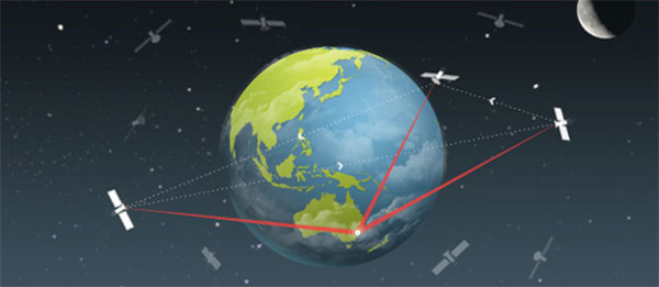
The GPS tracker coordinates are calculated according to the following principle. A radio signal passes from each navigation satellite to a receiver located in their access area. The delay of this signal is measured, and from these measurements the distance to each satellite is calculated. The location of the receiver is calculated based on measuring the distance from it to all available satellites (in geodesy this method is called triangulation), the coordinates of which are known and contained in the signals they transmit.
The GPS receiver is capable of not only determining its location, but also calculating the speed of movement, the time it takes to reach the designated place, and showing the direction. But this already applies not so much to the capabilities of the GPS system itself, but software navigator.
About the history of GPS and navigation satellites
The idea of creating a system satellite navigation Americans caught fire back in the 1950s, when the first artificial satellite Earth. In 1973, the DNSS program was launched, which was later renamed Navstar-GPS, and then simply GPS. The first satellite (test) was launched into orbit in 1974.
After the first Soviet navigation satellite GLONASS (Global Navigation Satellite System) was launched into orbit in 1982, the US Congress allocated funds to the US military to speed up the work. First worker GPS satellite was launched in February 1978, and the system began to function at full capacity at the end of 1993, when all 24 satellites took their places in Earth orbit.
Each navigation satellite weighs about 900-1000 kg, and in length with open solar panels reaches 5 meters. Average term satellite service life - 10 years. After this period, a new satellite is launched to replace the exhausted satellite.

About GPS receivers
The speed of calculating coordinates when the receiver is turned on, its sensitivity and positioning accuracy are determined by the chipset with which it is equipped. Chipsets for GPS devices are made by several manufacturers, but the most common is SiRFstarIII from SiRf Technology.
Receivers with the SiRfstarIII chipset have a short cold start time (a few seconds) and can simultaneously receive signals from 20 satellites. They are very sensitive and allow you to determine coordinates with high accuracy.
What is the difference between GPS and A-GPS
The list of characteristics of some smartphones indicates the presence of a GPS module, others - A-GPS. How are these modules different?
During a cold start (when the navigation system has not been used for a long time), a device with a conventional GPS receiver can search for satellites for a long time - the waiting time sometimes reaches 10 minutes or more. This is because the GPS receiver searches for satellites without knowing their location.
At using A-GPS the device immediately receives the part necessary information using a GPRS/3G network (traffic no more than 10 KB). Thus, A-GPS is a software add-on over the GPS receiver, which significantly reduces the time it takes to search for satellites during a cold start. In addition, this add-on allows you to increase the accuracy of location in areas with weak signal from satellites.
However, A-GPS has one small disadvantage. Unlike GPS, which is completely free to use, A-GPS must be paid according to the tariff set by your provider, since it consumes Internet traffic (however small).
Smartphones have long ceased to be simple dialers. They opened up a lot of new opportunities for their owners.
In the first place is full-fledged high-speed Internet access and communication in social networks and messengers. But GPS positioning is no less in demand, which we will now discuss in detail.
What is GPS?
GPS is a navigation system that determines the location of a smartphone, builds routes and allows you to find the desired object on the map.
Almost every modern gadget built-in GPS module. This is an antenna tuned to the signal of the system satellites GPS geolocation. It was originally developed in the USA for military purposes, but later its signal became available to everyone. The gadget's GPS module is a receiving antenna with an amplifier, but it cannot transmit a signal. Receiving a signal from satellites, the smartphone determines the coordinates of its location.
Almost every modern person has used GPS navigation on a smartphone or tablet at least once. The need for it can arise at any time among people of different professions and different types of occupations. It is necessary for drivers, couriers, hunters, fishermen and even ordinary pedestrians who find themselves in an unfamiliar city. Thanks to such navigation, you can determine your location, find the desired object on the map, build a route, and, if you have access to the Internet, avoid traffic jams.

Offline maps for GPS
Google has developed for its operating system Android special geolocation application - Google Maps. It quickly finds satellites, develops routes to objects and offers alternatives. Unfortunately, in the absence of cellular coverage Google network Maps doesn't work because geographic Maps here they are downloaded via the Internet.
For offline navigation, the best way is to download applications that support offline maps, such as Maps.me, Navitel and 2GIS. You can also install the Maps: Transportation and Navigation app for Google Maps.

In this case, you won’t have to spend Internet traffic to download maps - they will always be on your device, regardless of location. This is especially true when you are abroad, since the cost of roaming for Internet access is very high.
How to enable GPS on Android?
Activating the GPS module in the operating room Android system possible in two ways:
- Top curtain. Swipe down on the display and in the menu that opens, click the “Location”, “Geolocation” or “Geodata” button (depending on the Android version).
- IN Android settings Find the item similar items and move the checkbox to the “Enabled” position.

During active work navigation system smartphone, its battery charge begins to be consumed quite actively, so it is worth taking care of additional sources nutrition. For example, while driving you need to use car charging, and when traveling by bicycle or on foot - .
It is also worth remembering that confident reception satellite signal is possible in open areas, so when you are in a room or tunnel, geolocation becomes impossible. Cloudy weather also has an effect - because of the clouds, the device takes longer to search for satellites and determines its coordinates less accurately.

Not long ago GPS was the only system geolocation, so in the early Android versions only she was mentioned, and the service activation button was called that. Since 2010, the Russian one has been fully operational, and since 2012 -.