How to use a car navigator. Installing and configuring the Navitel navigator
Fifty years ago, humanity could not even imagine that amazing devices would appear in our lives to help make the lives of drivers easier. Every day, engineers from large companies try to create something new for people who spend a long time behind the wheel of a car. Modern, and much more helps car enthusiasts fully enjoy excellent sound quality and find the right road during long journeys.
But the most useful car device of our century, of course, has become a navigation system, thanks to which there is no need to use huge and inconvenient paper maps, wasting precious travel time on this. The driver only needs to turn it on, press just a few buttons and large display the route required for it will appear, which will indicate the distance and travel time, and a pleasant female voice will always remind you of.
How to use the navigator
As soon as you have purchased a modern navigator for your car, the first thing you do is open a brand new box where you will find electronic device, charging and, of course, operating instructions for the navigator. After studying the documents included with the navigator in detail, and then installing it, you need to configure it. To do this you need:
- Turn on the navigator.
- After turning it on, a picture should appear on your screen indicating that the navigator is looking for a satellite. As soon as the signal is received, “POSITION” will appear on the display, you will be able to view your location, namely the road on which your car is located.
- To make it convenient to use the map, you need to go to the “Menu”, go to “Settings” - “Map” - “Up map”, where you will see the choice of “north from above” and “rotate according to movement”. It is best to choose the latter, it is much more convenient to use while driving.
- To select a route for further use, press “Menu”. Several options will appear on the screen: “nearest on the map”; "by the address"; "favorite"; "waypoints"; "by coordinates". In our case, we will select “at address”.
- Then fields appear for entering a street, house and, accordingly, city. Entering is quite easy - when you type the first letters of the street, the program automatically gives the expected names. At the end of setting the full address, click the “go” button. If you cannot find the street you need, you write the one that is nearby, accordingly, also with the house number.
- The navigation system then automatically creates a route.

If the navigator has laid out a route that is inconvenient for you, for example, you need to go to one more place, you can correct it a little:
- To do this, move the card to the required point. Use your finger to click on that place, save and set a name for this point.
- Then click “Find” - “Waypoints” and select the desired city. “Show on map” immediately appears on the display, you just need to click on it, then a city map will open with the location you need. At the end of the whole process, you should click “Check In”.
- The program will automatically recalculate your complete route, indicate the distance and travel time. After adjusting each route, you only need to save it using the “Export” button.
You can select a route convenient for you in the navigation system, for example, by clicking the “Avoid when planning a route” button, which includes dirt roads, toll roads, highways, etc. You can also find out on the route whether there are hotels, cafes or gas stations nearby, you just need to mark the POI in the settings.

If your navigator is connected to the Internet, you can receive detailed information about traffic jams - this is convenient function will help you save time.
So that the navigator works efficiently and there is no interference in it successful work, it must be installed correctly inside the car. There are several simple rules for this:
- The navigator should be installed so that it does not interfere with your view while driving.
- The antenna built inside the navigator should not be covered with metal parts.
- Calculate the cable length for the navigation electronic device.
- Install it so that the display is not exposed to sunlight.
- The tilt angle of the screen should be positioned for the driver so that it is convenient to monitor the route while driving.
The navigator today has become an indispensable item for almost any person. Athletes, car enthusiasts, fishermen, mushroom pickers, and hunters actively use this device, which helps calculate routes, find or save a place and go there not using old “old-fashioned” methods or a compass, but using only modern technologies.
A GPS navigator is very necessary when moving through unfamiliar terrain. The device is easy to use; the main thing is to place it correctly on the front panel of the car and configure it.
Before use, read the instructions that come with the navigator. It can be paper or digital.
Then check the elements of the device and find out their purpose. Familiarize yourself with power, turning on, turning off. Set up navigation modes and view additional options.
Types and equipment
A car navigator helps you navigate the location of transport. GPS satellites transmit signals to the device in real time. All such equipment is divided into the following types:
- Built-in. Externally they look like a radio and are built into the on-board system of the car.
- Removable. They are installed on a special bracket and connected via the cigarette lighter.
A typical kit includes:
- stand with suction cup;
- cigarette lighter connection cord;
- battery for autonomous operation.
Software and features
Installation software depends on the functionality of the navigator. Most models have the software pre-installed, but you need to activate it before starting work.
Programs for navigators are created by CityGid, Navitel, Shturman, iGo, Progorod. The most commonly used software is from CityGuide and Navitel.
In some models, you can select a navigation program in which you can add new objects to the map. It can be road signs, permitted turns and traffic jam locations.
How to understand that the navigator has a program selection function:
- in the menu you need to select the command “Path to software” or “Navigation path”;
- after selecting the command, if such a function is available, it will be written that a microSD card can be connected to the device.
Navigators with a program provide location accuracy from 1 to 2 meters, determine the optimal path of movement, and correct data when changing direction. In addition, the device will tell you where you can go around an obstacle and calculate the duration of the route along with the calculation of the driving time.
Selecting a location
For a comfortable ride with a navigator, you must take into account the rules for its installation. This is also important for driving safety. The placement of the device should be selected according to personal convenience. But remember that when installed correctly, the device:
- leaves the overview as open as possible;
- does not cover the built-in antenna;
- does not allow glare on the display;
- provides convenient control over the route.
Connection
In the car, navigation equipment is connected through the cigarette lighter. But it can work autonomously from the built-in battery. When installing, make sure that you eventually have access to the memory slots. To connect, follow these steps:

It is important to adjust the gyroscope horizontally. Set it to be perpendicular to the ground.
Activation
Before activation, you can expand the functionality of the navigator and add necessary cards. To do this you will need a computer with internet.
You will need to go to the manufacturer’s website, register and log into your profile. Next activate license code from the disc packaging. After that on email You will receive an activation key, which you will need to enter into the navigator.
If everything is done correctly, a message indicating successful activation will appear on the screen.
Start of use
To start using a GPS device, you need:
- Select an installation location in the cabin.
- Activate the navigation system.
- Connect power.
- Enable and configure: Enter the time zone, coordinate system and units of measurement in the settings. Disable unwanted road types in "Navigation - Driving - Route Selection - Detours".
Navigation options
At this stage, the type of map is determined, its rotation in the direction of travel of the car, the mode of displaying the car on the road, the duration of the route and unnecessary objects on the map.
The map is configured through the menu " Navigation" And " Cards" To configure the auto display mode, go through the menu to the tabs " Automobile" And " Attraction", choose there optimal value at 50 meters.
Setting a route
The route is laid in several ways:
- by the address;
- on the map;
- by coordinates;
- by waypoints.
You can select the nearest routes on the map from the menu or save your own. After selecting and specifying a destination, the navigator plots a route taking into account the desired parameters. It can be adjusted by specifying additional points.
A GPS navigator is one of the most necessary devices for a car. It helps you navigate the area, build the shortest path and avoid obstacles. Each navigator has standard functions.
Among the popular manufacturers, Navitel and CityGid stand out. When choosing, also pay attention to the type of mount - it should be suitable for your car.
One of the most useful inventions of the last few years is the navigator. This device allows you to determine where you are, plot a route from point A to point B, and also choose the most suitable road for you. Many drivers from large cities now have a navigator, but it is now very difficult to imagine a taxi driver without a GPS navigator - almost everyone who works for any taxi company has one.
The GPS navigator has long been firmly established in our modern life thanks to all the conveniences it offers. True, any, even the most advanced GPS navigator can fail, because it’s just electronic device, so this device cannot be completely trusted.
What is a navigator for?
A GPS navigator exists to determine your location and see it on a map of the area. The navigator consists of a receiver that receives a signal from a satellite. The navigator decrypts the signal and thus determines the location of the receiver. True, to get all the conveniences that this device provides, you need to know how to use a GPS navigator.
Depending on your needs, you can choose any navigator; fortunately, these devices now exist in a huge range, from tourist to automobile.
Let's start using the navigator
First, let's figure out how to use an ordinary navigator, that is, a tourist one. First, you need to examine the navigator interface, since these devices are most often multifunctional and contain many buttons. First of all, it is advisable to read the instructions for the navigator, remember which buttons do what, and initial settings. You need to select a coordinate system and time zone. The main thing is to set the unit of distance measurement - in some navigators, by default, distance is measured in miles, not kilometers. You can also set special alarms. If your navigator already has initial settings, then you can skip this step.
What can a navigator do?
In the navigator you can view your current position, geographical coordinates any point and trajectory of your movement. Any navigator has several pages with different information, which can be scrolled through.
To remember the coordinates, you need to hold a certain button for several seconds. You can also do this in the main menu. There you can select a saved coordinate and start moving along the selected path.
The path you have taken is automatically saved in the navigator's memory, but this can be canceled in the settings. There is also an auto-routing function - automatic route planning. To do this, you need to select the end point of the path, and the device will independently select for you the shortest and fast way. When turning, the navigator produces certain signals.
With certain software, you can load it into the navigator additional cards, routes and additional programs. But in any case, any navigator must have General Map world, indicating regions, major cities, roads. Before using a map, it is advisable to look through it and check the main positions, because these maps are actually compiled manually, and no one can be immune from basic human error. There are often cases when navigators let an unlucky driver go around in circles, especially in those parts of the road where there are many exits. On such sections of the route, if the navigator is slightly inaccurate, you can get stuck for a very long time.
Phone navigator
In addition to ordinary navigator devices, gps navigators is now in almost every smartphone. If you still don’t know how to use the navigator on your phone, don’t worry - everything is so simple that you only need minimal knowledge. There is no need to configure the settings there - just load the card via a USB cable or directly to your phone, then search bar write the address and you will receive a route to point B. In some navigation systems you can even choose the type of movement - depending on whether you walk, travel by personal transport or public transport, the route changes.
Yandex.Navigator is one of the most common navigators for Android OS in Russia. The application boasts rich functionality, an interface entirely in Russian and the absence intrusive advertising. Another indisputable advantage is that it is absolutely free. The rest of the article will tell you how to use Yandex.Navigator on your smartphone.
After reading the material below, you will learn how to set up a navigator, get directions online and offline, and use its additional tools in unexpected situations on the road.
Step 1: Install the application
To download Yandex.Navigator on Android smartphone, follow the link below, click on the button "Install" and wait for the application to finish downloading to your smartphone.

Step 2: Setup
- In order for the navigator to be convenient to use, you need to customize it for yourself. Therefore, after installation, go to Yandex.Navigator by clicking on the application icon on the desktop of your smartphone.
- When you first launch it, two requests for permission to allow the application to access geolocations and the microphone will pop up on the screen. For correct operation Yandex.Navigator is recommended to give your consent - click "Allow" in both cases.
- Next, click on the button "Menu" in the lower right corner of the screen and go to "Settings". First there will be a column of settings related to the card. Let's consider only those that really affect the use of the navigator.
- Go to the tab "Card view" and choose between standard scheme streets and roads or satellite. Everyone sees maps differently, but schematic maps are more convenient to use.
- To use the navigator offline, go to the menu item and click on the search bar. Next, select the proposed maps of countries, regions, territories, cities and numerous provinces or use the search by writing the name of the area you need.
- To change your location icon, go to the tab "Cursor" and choose one of three options.
- Another important settings column is "Sound".
- For selection voice assistant go to the tab "Speaker" and select the voice acting you are interested in. On foreign languages there will be standard male and female voices, and six positions are available in Russian.
- For complete convenience, it is advisable to leave the remaining three items enabled. Voice activation will help you plot your route without taking your eyes off the road. Just say the destination address after the command "Listen, Yandex".


Once you confirm your permissions, a map will open with an arrow icon showing your location.


To select the language you are interested in, in which the navigator will show you the route and other information about the road, go to the appropriate tab and click on one of the proposed languages. Then, to return to settings, click on the arrow on the left top corner.


This concludes the basic settings for ease of use of the navigator. There will be a few more items at the bottom of the list of parameters, but they are not so significant that we need to focus on them.
Step 3: Using the Navigator


After that, you just have to follow the instructions of the announcer. But do not forget that this is a technique that can sometimes make mistakes. Pay close attention to the road and road signs.
Yandex.Navigator can also show traffic congestion to avoid getting stuck in a traffic jam. To activate this function, click on the traffic light icon in the upper right corner. After this, the city roads will become multi-colored, which indicates their congestion in this moment. Roads are green, yellow, orange and red - the gradation goes from a free road to a long-term traffic jam.

For user convenience, Yandex.Navigator developers have added the function of indicating comments on road events, which are available to any driver or pedestrian who is not indifferent to incidents. If you want to add an event, click on the triangle icon with a plus inside.

A list of pointers that you can place on the map with any comment will immediately open at the top of the screen. Whether it's an accident, road repairs, cameras or any other incident, select the desired sign, write a comment, point to the desired place and click "Install".

Then a small pointer will be visible on the map at this location. Click on it and you will see information from the user.

Recently, Yandex.Navigator added a function for displaying parking lots. To activate it, click on the button in the lower left corner in the form English letter "P".

Now on the map you will see all the parking spaces available in that locality, where are you at. They will be highlighted with blue stripes.

At this step, the main work with the navigator is completed. Additional options will be discussed next.
Step 4: Work offline
If you don’t have the Internet at hand, but have a working smartphone with a GPS receiver, then Yandex.Navigator will help you get to desired point. But only on the condition that maps of your area have already been downloaded to your smartphone or the route you have previously built has been saved.
With the available maps, the route construction algorithm will be similar to the online mode. And in order to save the required route in advance, click on the button "My places".

The next step is to indicate your home and work addresses, and in the line "Favorites" add the addresses where you often go.

Now to use the app offline with pre-loaded maps, say voice command "Listen, Yandex" and specify or manually select the place where you want to route.
Step 5: Working with Tools
The menu has a group of tabs called "Tools", and several of them may be useful to you. They only work with an active Internet connection on your Android smartphone.


This concludes our instructions for using the application. There are many interesting and long existing solutions of this kind, but Yandex.Navigator boldly stands among them on good standing for many users. Therefore, feel free to install it on your device and enjoy it.
Today it is difficult to find a driver whose car does not have an electronic navigator. After all, road atlases, topographic maps and diagrams made using printing methods are gradually becoming a thing of the past. Their place is taken by multifunctional electronic gadgets, which can be used while driving vehicle, more comfortable. For such devices, special software is being developed that allows you to use a smartphone or compact tablet.
One of the most famous developers and suppliers of licensed software in the field of navigation services and digital cartography in Russia and the post-Soviet space is JSC CNT. All products of this company are sold under the Navitel brand.
Multiplatform navigation is the most popular among users of navigation equipment. Navitel Navigator, successfully working with operating systems Symbian, Mobile, Android, IPhone, Bada, Windows, Windows CE, Java and iPad. In addition to detailed navigation maps Russia and other countries (CIS, Europe, Asia, America), the Navitel Navigator program provides access to free Navitel navigation services:
- "Traffic jams",
- "Events",
- "Dynamic POI"
- "Friends",
- "Weather".
The ever-increasing popularity of the Navitel Navigator navigation program is due to its speed and high positioning accuracy. Producing a large number of mathematical calculations of various geodetic parameters, the program is able to display not one, but several route options, prompting the driver to choose the optimal one.
Attention! Due to its advantages, Navitel Navigator is increasingly included in regular multimedia devices installed directly at car manufacturers.
In this regard, the CNT company has recently begun producing its own navigators equipped with navigation programs own development.
Currently, the Navitel line of navigators includes 6 models. The flagship of the line is the Navitel A737 navigator.
Installing and configuring the Navitel navigator
Despite the fact that the design and functionality both navigators and their software are constantly being improved, installation and initial setup Navitel navigator remains invariably simple. Almost any car owner can do it. To do this, you need to know about the main features of such a device.
Installation
The Navitel navigator is usually installed on dashboard or Windshield car. For this purpose, the kit includes a special suction cup mounting device. When installing the device, consider the following factors:
- The navigator is able to accurately determine its location by receiving information from at least four satellites. If their number is less, the warning message “Insufficient data” will appear on the display;
- When installing the navigator, you must ensure that there are no shielding objects nearby (foil, metal sheets, etc.). In the presence of such items, the device may malfunction, despite the existing protection;
- The wires used to charge or operate the navigator from the car cigarette lighter should not be too tight. It must be remembered that a large amount of wire lying loosely near the device is also undesirable.
Settings
One of the main advantages of Navitel navigators is the ease of initial setup.
During the first launch, the program initializes itself, and then sets several simple questions, which must be answered by pressing the appropriate buttons.
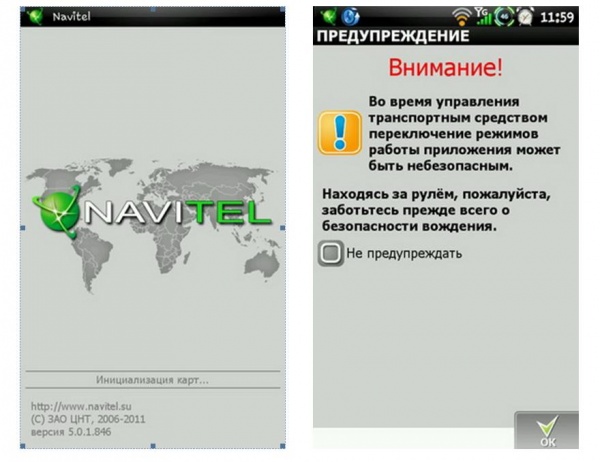
Ends initial setup Navitel navigator voice message"Connection with satellites established."
In addition, you can use the button " Additional settings" In this tab, the Navitel Navigator program configures the time and date display format. You can also turn the sound on or off.
In the future, working with the navigator will not present any difficulty. All necessary preliminary positioning operations are performed by the high-speed GLONASS/GPS navigation CHIP when the device is turned on.
The most difficult operation is considered to be laying out a preliminary route. In this case, you must be guided by the hints that pop up in the necessary places.
To configure the movement, the owner of the Navitel navigator must perform the following operations:
.jpg)
You can set the end point of the route in other ways, for example, using the submenu “Points of interest” (POI), “Waypoints”, “History”, “Favorites”, “By coordinates” or “Navitel SMS”.


After the final destination is entered and the program marks it with a flag on the map, press the “Go” button and the route will appear on the display.
While driving, you may need to stop somewhere. If you need to change the route, you just need to mark this place on the map. In this case, the “Check in” and “Continue” buttons are activated.

Clicking on the “Drive” button will change the route on the map, and subsequent clicking on the “Continue” button will again display the route to the end point.
While driving, the image on the map is not cluttered with unnecessary information. Only the most necessary data is provided.

Following the proverb “It is better to see once than to hear 100 times” the whole process correct settings You can see the route on the Navitel navigator in a short video: